Master
English
Social Sciences
Master of Science in GeoinformaticsGeoinformatics
Master

About the Program
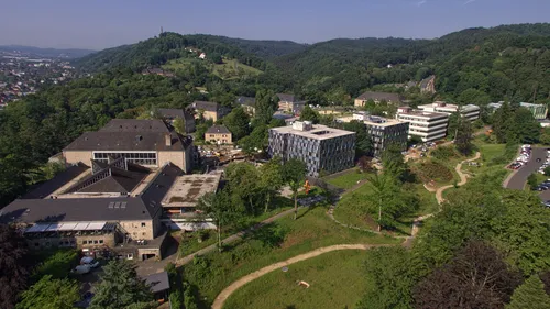
MSc in Geoinformatics Trier University's Master's in Geoinformatics is a study programme offered by the Faculty of Regional and Environmental Science in collaboration with the faculties of Mathematics, Computer Science, and Business Informatics. It is coordinated by the Environmental Remote Sensing and Geoinformatics lab and Spatial Data Sciences lab. The programme focuses on the combined use of quantitative remote sensing methods with GIS techniques to develop advanced mapping approaches for environmental observation and monitoring. A special emphasis is placed on geospatial technologies, remote sensing, and visualisation methods. The programme requires 120 ECTS credit points, comprised of ten core courses and six to eight elective courses, corresponding to 16 to 18 graduate course units. The elective component allows students to tailor their studies to their specific interests (e.g. remote sensing methods, survey statistics, or database technologies). The programme concludes with a scientific Master's project, which students must complete and defend successfully. The Master's programme is designed for applicants holding a Bachelor's degree in Geoinformatics or a related field. It aims to develop advanced methodological and computational skills, preparing graduates for careers in the public and private sectors, including consultant agencies, insurance companies, and many others. Graduates will be well prepared to pursue PhD programmes or research careers in national and international universities and research institutions.
▶ Show the original English text
MSc in Geoinformatics Trier University's Master's in Geoinformatics is a study programme offered by the Faculty of Regional and Environmental Science in collaboration with the faculties of Mathematics, Computer Science, and Business Informatics. It is coordinated by the Environmental Remote Sensing and Geoinformatics lab and Spatial Data Sciences lab. The programme focuses on the combined use of quantitative remote sensing methods with GIS techniques to develop advanced mapping approaches for environmental observation and monitoring. A special emphasis is placed on geospatial technologies, remote sensing, and visualisation methods. The programme requires 120 ECTS credit points, comprised of ten core courses and six to eight elective courses, corresponding to 16 to 18 graduate course units. The elective component allows students to tailor their studies to their specific interests (e.g. remote sensing methods, survey statistics, or database technologies). The programme concludes with a scientific Master's project, which students must complete and defend successfully. The Master's programme is designed for applicants holding a Bachelor's degree in Geoinformatics or a related field. It aims to develop advanced methodological and computational skills, preparing graduates for careers in the public and private sectors, including consultant agencies, insurance companies, and many others. Graduates will be well prepared to pursue PhD programmes or research careers in national and international universities and research institutions.
Which Professions Does This Program Open Up?
Related profession searches from Bundesagentur für Arbeit (BERUFENET) data:
Explore all professions →Subjects / Topic Areas
Geoinformatics
Similar Programs
Interreligious Studies
Universität Heidelberg
Master of Arts (M.A.)
Public History
Freie Universität Berlin, E-Medien
Master of Arts (M.A.)
Empirical Political and Social Research
Universität Stuttgart
Master of Arts (M.A.)
Jewish Theology
Universität Potsdam
Master of Arts (M.A.)
Mind, Brain and Behavior
Justus-Liebig-Universität Gießen
Master of Science (M.Sc.)
Vocational Education Nutritional Science and Home Economics
Hochschule Osnabrück
Master of Education (M.Ed.)
How do I apply to Master of Science in Geoinformatics at Hochschule für Angewandte Wissenschaft/Trier University of Applied Science?
Most international applicants apply via uni-assist (document verification + APS for some countries). Prepare your secondary/Bachelor diploma, transcripts, language certificate (DSH/TestDaF or IELTS/TOEFL), motivation letter and CV. Non-EU students also need a Sperrkonto (~11,904 EUR/year) for the visa.
- Check requirements — Verify your degree is recognised + meet language/grade thresholds.
- Get language certificate — TestDaF / DSH for German programmes, IELTS / TOEFL for English.
- Submit via uni-assist (non-EU) — Document review + APS if your country requires it (China, India, Pakistan, Vietnam, etc.).
- Apply directly or via uni portal — Some universities accept direct applications — check the official programme page.
- Open Sperrkonto + apply for visa — After admission, deposit 11,904 EUR, get health insurance, book embassy appointment.
Frequently Asked Questions
Quick answers about Master of Science in Geoinformatics at Hochschule für Angewandte Wissenschaft/Trier University of Applied Science
Is Master of Science in Geoinformatics at Hochschule für Angewandte Wissenschaft/Trier University of Applied Science taught in German or English? ▼
This Master programme is taught in English. Make sure to check the language requirements (e.g. TestDaF, DSH, IELTS or TOEFL) before applying.
How much does the Master of Science in Geoinformatics programme cost? ▼
No tuition fee (only semester contribution). International students should also budget around 800–1000 EUR/month for living costs in Germany.
What are the admission requirements for Master of Science in Geoinformatics at Hochschule für Angewandte Wissenschaft/Trier University of Applied Science? ▼
Typical requirements include: a recognised secondary/undergraduate degree, proof of language proficiency (English), and (for non-EU applicants) a uni-assist application plus financial proof (Sperrkonto ~11.904 EUR/year).
When is the application deadline? ▼
Application deadlines vary: winter semester usually closes on 15 July, summer semester on 15 January. Always confirm the exact deadline on the official university website.
Can I work in Germany while studying Master of Science in Geoinformatics? ▼
Yes. International students may work up to 140 full days / 280 half days per year without additional permission. After graduation you can apply for an 18-month job-seeker permit.
How do I apply to Hochschule für Angewandte Wissenschaft/Trier University of Applied Science — directly or via uni-assist? ▼
Most German universities accept international applications through uni-assist for document verification. Some unis accept direct applications — check the programme page on the official site.