Master
Englisch
Sozialwissenschaften
Master of Science in Geoinformatics
Master

Über das Programm
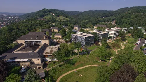
MSc in Geoinformatics Trier University's Master's in Geoinformatics is a study programme offered by the Faculty of Regional and Environmental Science in collaboration with the faculties of Mathematics, Computer Science, and Business Informatics. It is coordinated by the Environmental Remote Sensing and Geoinformatics lab and Spatial Data Sciences lab. The programme focuses on the combined use of quantitative remote sensing methods with GIS techniques to develop advanced mapping approaches for environmental observation and monitoring. A special emphasis is placed on geospatial technologies, remote sensing, and visualisation methods. The programme requires 120 ECTS credit points, comprised of ten core courses and six to eight elective courses, corresponding to 16 to 18 graduate course units. The elective component allows students to tailor their studies to their specific interests (e.g. remote sensing methods, survey statistics, or database technologies). The programme concludes with a scientific Master's project, which students must complete and defend successfully. The Master's programme is designed for applicants holding a Bachelor's degree in Geoinformatics or a related field. It aims to develop advanced methodological and computational skills, preparing graduates for careers in the public and private sectors, including consultant agencies, insurance companies, and many others. Graduates will be well prepared to pursue PhD programmes or research careers in national and international universities and research institutions.
▶ Den originalen englischen Text anzeigen
MSc in Geoinformatics Trier University's Master's in Geoinformatics is a study programme offered by the Faculty of Regional and Environmental Science in collaboration with the faculties of Mathematics, Computer Science, and Business Informatics. It is coordinated by the Environmental Remote Sensing and Geoinformatics lab and Spatial Data Sciences lab. The programme focuses on the combined use of quantitative remote sensing methods with GIS techniques to develop advanced mapping approaches for environmental observation and monitoring. A special emphasis is placed on geospatial technologies, remote sensing, and visualisation methods. The programme requires 120 ECTS credit points, comprised of ten core courses and six to eight elective courses, corresponding to 16 to 18 graduate course units. The elective component allows students to tailor their studies to their specific interests (e.g. remote sensing methods, survey statistics, or database technologies). The programme concludes with a scientific Master's project, which students must complete and defend successfully. The Master's programme is designed for applicants holding a Bachelor's degree in Geoinformatics or a related field. It aims to develop advanced methodological and computational skills, preparing graduates for careers in the public and private sectors, including consultant agencies, insurance companies, and many others. Graduates will be well prepared to pursue PhD programmes or research careers in national and international universities and research institutions.
Welche Berufe eröffnet dieses Programm?
Verwandte Berufssuchen aus Daten der Bundesagentur für Arbeit (BERUFENET):
Alle Berufe entdecken →Fächer / Themenbereiche
Geoinformatics
Ähnliche Programme
Interreligious Studies
Universität Heidelberg
Master of Arts (M.A.)
Public History
Freie Universität Berlin, E-Medien
Master of Arts (M.A.)
Empirical Political and Social Research
Universität Stuttgart
Master of Arts (M.A.)
Jewish Theology
Universität Potsdam
Master of Arts (M.A.)
Mind, Brain and Behavior
Justus-Liebig-Universität Gießen
Master of Science (M.Sc.)
Vocational Education Nutritional Science and Home Economics
Hochschule Osnabrück
Master of Education (M.Ed.)
Wie bewerbe ich mich für Master of Science in Geoinformatics an der Hochschule für Angewandte Wissenschaft/Trier University of Applied Science?
Die meisten internationalen Bewerber bewerben sich über uni-assist (Dokumentenprüfung + APS für einige Länder). Bereite dein Abitur-/Bachelor-Diplom, Zeugnisse, Sprachzertifikat (DSH/TestDaF oder IELTS/TOEFL), Motivationsschreiben und Lebenslauf vor. Nicht-EU-Studenten benötigen für das Visum auch ein Sperrkonto (~11.904 EUR/Jahr).
- Anforderungen prüfen — Überprüfe, ob dein Abschluss anerkannt ist + erfülle die Sprach-/Notenschwellen.
- Sprachzertifikat erwerben — TestDaF / DSH für deutsche Studiengänge, IELTS / TOEFL für englische.
- Über uni-assist einreichen (Nicht-EU) — Dokumentenprüfung + APS, falls dein Land dies erfordert (China, Indien, Pakistan, Vietnam usw.).
- Direkt oder über das Uni-Portal bewerben — Einige Universitäten akzeptieren Direktbewerbungen — überprüfe die offizielle Programmseite.
- Sperrkonto eröffnen + Visum beantragen — Nach der Zulassung 11.904 EUR einzahlen, Krankenversicherung abschließen, Botschaftstermin buchen.
Häufig gestellte Fragen
Kurze Antworten zu Master of Science in Geoinformatics an der Hochschule für Angewandte Wissenschaft/Trier University of Applied Science
Wird Master of Science in Geoinformatics an der Hochschule für Angewandte Wissenschaft/Trier University of Applied Science auf Deutsch oder Englisch unterrichtet? ▼
Dieser Master Studiengang wird in Englisch unterrichtet. Stelle sicher, dass du die Sprachanforderungen (z.B. TestDaF, DSH, IELTS oder TOEFL) vor der Bewerbung überprüfst.
Wie viel kostet der Studiengang Master of Science in Geoinformatics? ▼
Keine Studiengebühren (nur Semesterbeitrag). Internationale Studierende sollten zusätzlich etwa 800–1000 EUR/Monat für Lebenshaltungskosten in Deutschland einplanen.
Was sind die Zulassungsvoraussetzungen für Master of Science in Geoinformatics an der Hochschule für Angewandte Wissenschaft/Trier University of Applied Science? ▼
Typische Anforderungen sind: ein anerkannter Sekundar-/Bachelorabschluss, Nachweis der Sprachkenntnisse (Englisch) und (für Nicht-EU-Bewerber) eine uni-assist Bewerbung plus Finanzierungsnachweis (Sperrkonto ~11.904 EUR/Jahr).
Wann ist die Bewerbungsfrist? ▼
Die Bewerbungsfristen variieren: Das Wintersemester endet in der Regel am 15. Juli, das Sommersemester am 15. Januar. Bestätige die genaue Frist immer auf der offiziellen Universitätswebsite.
Kann ich während des Studiums von Master of Science in Geoinformatics in Deutschland arbeiten? ▼
Ja. Internationale Studierende dürfen ohne zusätzliche Genehmigung bis zu 140 volle Tage / 280 halbe Tage pro Jahr arbeiten. Nach dem Abschluss kannst du eine 18-monatige Arbeitserlaubnis zur Jobsuche beantragen.
Wie bewerbe ich mich an der Hochschule für Angewandte Wissenschaft/Trier University of Applied Science — direkt oder über uni-assist? ▼
Die meisten deutschen Universitäten akzeptieren internationale Bewerbungen zur Dokumentenprüfung über uni-assist. Einige Universitäten akzeptieren Direktbewerbungen — überprüfe die Programmseite auf der offiziellen Website.