Master
English
Social Sciences
Master of Science in Cartography
Master

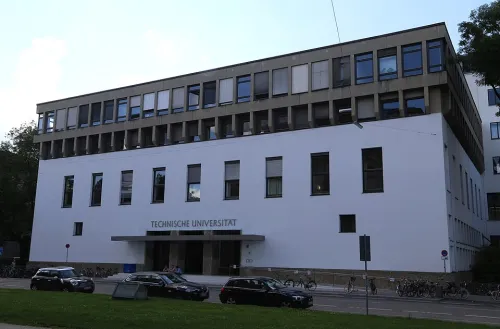
About the Program
The programme focuses on a comprehensive education in cartography and geoinformatics, in particular on spatial information technologies, mathematic principles of map making, spatial data handling, theories and technologies of visual analytics, geovisualisation and communication of spatial information. The curriculum is structured in compulsory and elective modules. It is based on lectures, exercises, seminars, and project works. During the first semester at TUM, the foundations in cartography and geovisualisation are taught. In the second semester at TUW, students gain knowledge in multimedia cartography, especially, in web mapping, mobile internet and location-based services (LBS). Students specialise in mobile cartography and 3D cartography in the third semester at TUD. During the first and third semester, students have the possibility to choose online modules from the University of Twente within the elective module catalogue.
▶ Show the original English text
The programme focuses on a comprehensive education in cartography and geoinformatics, in particular on spatial information technologies, mathematic principles of map making, spatial data handling, theories and technologies of visual analytics, geovisualisation and communication of spatial information. The curriculum is structured in compulsory and elective modules. It is based on lectures, exercises, seminars, and project works. During the first semester at TUM, the foundations in cartography and geovisualisation are taught. In the second semester at TUW, students gain knowledge in multimedia cartography, especially, in web mapping, mobile internet and location-based services (LBS). Students specialise in mobile cartography and 3D cartography in the third semester at TUD. During the first and third semester, students have the possibility to choose online modules from the University of Twente within the elective module catalogue.
General Requirements
Specific requirements for this program are not in our database yet. The following are typical for this degree and language in Germany — always verify the exact requirements on the program's official page.
Academic qualification
A recognised Bachelor's degree in a related field; some programs require a minimum grade or specific prerequisites.
Language
English proficiency (typically IELTS ~6.5 or TOEFL iBT ~90). Basic German is helpful for daily life.
Typical documents
- Recognised diploma and transcript (certified translations)
- Language certificate
- Passport and passport photo
- Tabular CV (Lebenslauf)
- Letter of motivation (for many programs)
- Application via uni-assist / VPD (for most international applicants)
Which Professions Does This Program Open Up?
Related profession searches from Bundesagentur für Arbeit (BERUFENET) data:
Explore all professions →Subjects / Topic Areas
Geodesy
Similar Programs
Interreligious Studies
Universität Heidelberg
Master of Arts (M.A.)
Public History
Freie Universität Berlin, E-Medien
Master of Arts (M.A.)
Empirical Political and Social Research
Universität Stuttgart
Master of Arts (M.A.)
Jewish Theology
Universität Potsdam
Master of Arts (M.A.)
Mind, Brain and Behavior
Justus-Liebig-Universität Gießen
Master of Science (M.Sc.)
Vocational Education Nutritional Science and Home Economics
Hochschule Osnabrück
Master of Education (M.Ed.)
How do I apply to Master of Science in Cartography at Technische Universität München?
Most international applicants apply via uni-assist (document verification + APS for some countries). Prepare your secondary/Bachelor diploma, transcripts, language certificate (DSH/TestDaF or IELTS/TOEFL), motivation letter and CV. Non-EU students also need a Sperrkonto (~11,904 EUR/year) for the visa.
- Check requirements — Verify your degree is recognised + meet language/grade thresholds.
- Get language certificate — TestDaF / DSH for German programmes, IELTS / TOEFL for English.
- Submit via uni-assist (non-EU) — Document review + APS if your country requires it (China, India, Pakistan, Vietnam, etc.).
- Apply directly or via uni portal — Some universities accept direct applications — check the official programme page.
- Open Sperrkonto + apply for visa — After admission, deposit 11,904 EUR, get health insurance, book embassy appointment.
Frequently Asked Questions
Quick answers about Master of Science in Cartography at Technische Universität München
Is Master of Science in Cartography at Technische Universität München taught in German or English? ▼
This Master programme is taught in English. Make sure to check the language requirements (e.g. TestDaF, DSH, IELTS or TOEFL) before applying.
How much does the Master of Science in Cartography programme cost? ▼
No tuition fee (only semester contribution). International students should also budget around 800–1000 EUR/month for living costs in Germany.
What are the admission requirements for Master of Science in Cartography at Technische Universität München? ▼
Typical requirements include: a recognised secondary/undergraduate degree, proof of language proficiency (English), and (for non-EU applicants) a uni-assist application plus financial proof (Sperrkonto ~11.904 EUR/year).
When is the application deadline? ▼
Application deadlines vary: winter semester usually closes on 15 July, summer semester on 15 January. Always confirm the exact deadline on the official university website.
Can I work in Germany while studying Master of Science in Cartography? ▼
Yes. International students may work up to 140 full days / 280 half days per year without additional permission. After graduation you can apply for an 18-month job-seeker permit.
How do I apply to Technische Universität München — directly or via uni-assist? ▼
Most German universities accept international applications through uni-assist for document verification. Some unis accept direct applications — check the programme page on the official site.